
Moderate
Best Seller
₹7,999 per person
View Details
Sar Pass Trek
4N/5D
13,800m
48 km
The Sar Pass trek offers a five-day trek to a high pass at 13,800 feet in Himachal Pradesh.
April May June
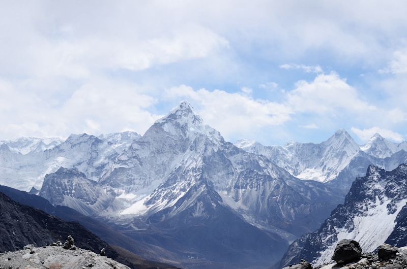
Roopkund Trek
Ever heard of a lake that holds bones from long ago? The Roopkund trek leads you to a high lake with old human bones. You can see these bones right through the clear, cold water below. This path climbs up to 16,500 ft in the great hills. Snow peaks stand all around you at this grand height up here.
Your route moves through thick woods, soft grass lands, and hard rock trails. The well-known Ali and Bedni Bugyal fields lie on your path going up. This strange bone lake sets the Roopkund trek apart from all other walks. The sight of these old bones stays in your mind for years ahead.
This walk ranks from mid-level to hard and needs eight days to finish. May through June and September through October work best for this Roopkund trek. Bring thick warm gear and strong boots built for rough mountain ground.
Arrival at Kathgodam Route: Kathgodam to Lohajung (Drive) Distance: 210 km | Duration: 10 hours | Altitude: 7,700 ft
Begin your journey with a scenic drive from Kathgodam to Lohajung. Pass through beautiful mountain roads, small villages, and pine forests. Reach the base camp at Lohajung and settle into your accommodation for the night.
Route: Kathgodam - Bheem Tal - Almora - Dewal - Lohajung.
Trek to Didna Village Route: Lohajung to Didna Village
Distance: 11 km
Duration: 6-7 hours | Altitude: 8,600 ft
Start your first day of trekking through dense oak and rhododendron forests. The trail gradually ascends with stunning valley views. Cross wooden bridges over mountain streams and reach the remote Didna village, where you'll camp for the night.
Trek to Ali Bugyal Route: Didna Village to Ali Bugyal
Distance: 10 km
Duration: 5-6 hours | Altitude: 11,680 ft
Trek through thick forests that open up to reveal the magnificent Ali Bugyal meadows. These vast grasslands offer panoramic views of Himalayan peaks, including Trishul and Nanda Ghunti. Camp amidst the beautiful meadows under a star-filled sky.
Trek to Bedni Bugyal via Ghairoli Patal Route: Ali Bugyal to Ghairoli Patal to Bedni Bugyal
Distance: 6 km
Duration: 4-5 hours | Altitude: 11,900 ft
Walk through rolling meadows to reach Ghairoli Patal, then continue to Bedni Bugyal, one of India's most beautiful alpine meadows. Visit the ancient Bedni Kund lake near the campsite and enjoy spectacular mountain views all around.
Trek to Bhagwabasa Route: Bedni Bugyal to Bhagwabasa
Distance: 6 km |
Duration: 4-5 hours | Altitude: 14,200 ft
Climb through rugged terrain as vegetation starts to thin out. The landscape becomes rocky and barren as you gain altitude. Camp at Bhagwabasa, the last camping site before Roopkund, and prepare for the early morning summit push.
Summit Day - Roopkund Lake Route: Bhagwabasa to Roopkund to Bedni Bugyal
Distance: 14 km
Duration: 9-10 hours | Altitude: 16,500 ft (max)
Start before dawn to reach the mysterious Roopkund Lake. See ancient human skeletons visible in the glacial waters. Enjoy breathtaking 360-degree views of major Himalayan peaks. After spending time at the lake, descend back to Bedni Bugyal for overnight camping.
Descend to Lohajung Route: Bedni Bugyal to Didna Village to Lohajung
Distance: 21 km
Duration: 8-9 hours | Altitude: 7,700 ft
Begin the long descent back through the meadows and forests. Retrace your steps through Didna village and continue down to Lohajung. Celebrate the successful completion of your trek with your team at the base camp.
Departure from Lohajung Route: Lohajung to Kathgodam (Drive)
Distance: 210 km
Duration: 10 hours
Drive back to Kathgodam through the winding mountain roads. Carry amazing memories of the mysterious Roopkund lake, beautiful meadows, and stunning Himalayan peaks. Reach Kathgodam by evening for your onward journey home.
High fitness level required
Previous high altitude trekking experience recommended
Detailed plan sent to WhatsApp
What you'll get:
Explore more adventures in Chamoli , Uttarakhand and nearby regions
The Sar Pass trek offers a five-day trek to a high pass at 13,800 feet in Himachal Pradesh.
Complete Valley of Flowers trek itinerary with day-wise plan, distance, altitude, best time to visit, permits, and packing list. Easy 6-day trek guide from Hari
The Hampta Pass trek connects the Kullu and Lahaul valleys, crossing a 14,100-foot pass and Chandratal Lake in 5 days.
A perfect winter trek with pristine snow trails and 360-degree summit views.